Two 12th-Century Bridges in China and Cambodia Reveal Very Different Feats of Engineering
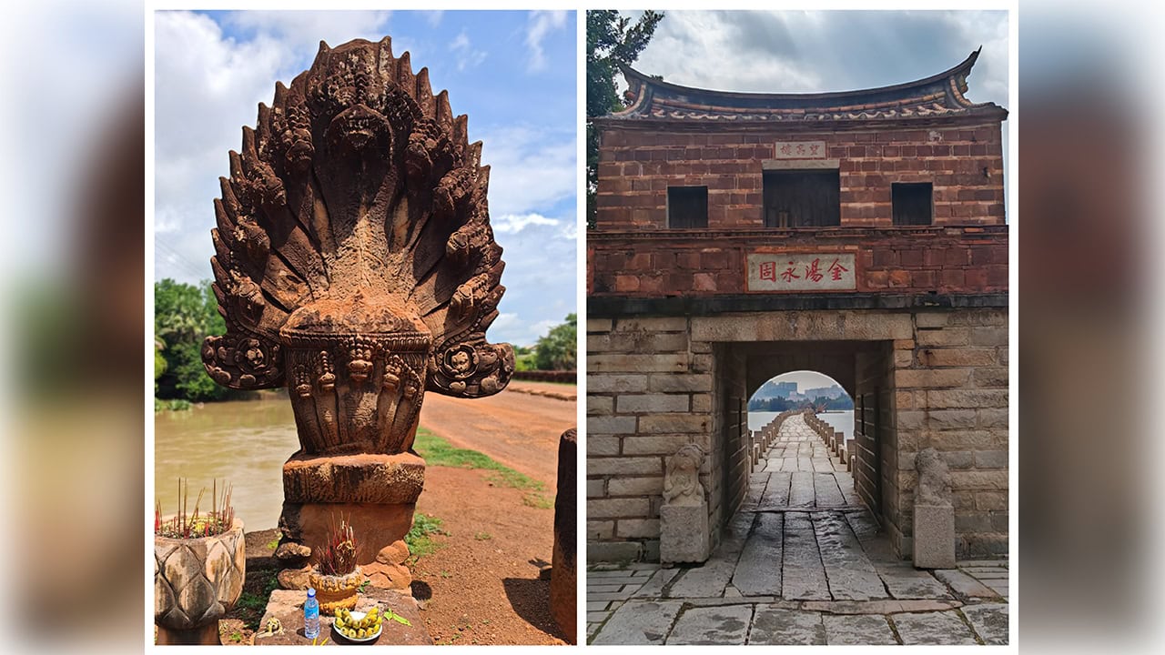
Almost nine centuries ago, builders in China's Fujian province were setting enormous granite slabs across a tidal estuary at roughly the same time that Khmer engineers were raising stone-arched bridges along the roads of the Angkorian Empire.
Created in contrasting landscapes and for different reasons, China's Anping Bridge and Cambodia's Spean Praptos, better known as the Kampong Kdei Bridge, still stand as remarkable examples of sophisticated 12th-century engineering.
Crossing the tides at Anping
A group of ASEAN journalists toured the Anping Bridge in Anhai town, Jinjiang, on 22 September, where a Chinese guide described how the original builders coped with a soft seabed, strong tidal currents and the challenge of hauling stones weighing several tonnes.
The bridge links Anhai town in Jinjiang with Shuitou town in Nan'an. Both county-level cities fall under the administration of Quanzhou, in Fujian province.
Work started in 1138 under the Southern Song dynasty and finished in 1152, meaning construction began 888 years ago and the finished bridge has now endured for roughly 874 years.
The structure runs for about 2.25km and varies in width from 2.9m to 4m. It is also called Wuli Bridge, or Five-Li Bridge, since its length was close to five traditional Chinese li.
"The longest stone slab reaches about 11m, and the heaviest weighs about 25 tonnes," the guide told the visitors as they walked across the ancient span.
Lacking cranes, the builders moved the granite by boat and relied on the rise and fall of the tides to lift the slabs into place above the piers. Some local traditions hold that part of the stone came from Kinmen and neighbouring islands, though the origin of all the granite has never been firmly confirmed.
Foundations, oysters and pier design
Anping Bridge also made use of a "sleeper-log foundation" method. Builders laid timber logs across the soft mud, then piled heavy stones on top, slowly pressing the foundation down toward a firmer load-bearing layer.
Oysters that grew on the submerged sections helped hold the stonework together and shielded it from waves and erosion. Contrary to some accounts, they did not secrete any bonding liquid; instead their shells built up around the masonry and reinforced its surface.
To handle varying currents, the engineers used three types of pier: rectangular, single-pointed or half-boat-shaped, and double-pointed boat-shaped. Official records generally list 360 piers — 290 rectangular, 44 single-pointed and 26 double-pointed — though some accounts put the total at 361. The bridge contains 362 water openings.
The crossing supported trade and travel between Quanzhou and regions further south, a sign of the wealth generated by maritime commerce during the Song and Yuan eras. In 2021 it became one of 22 sites included in the UNESCO listing "Quanzhou: Emporium of the World in Song–Yuan China".
Cambodia's stone-arch alternative
Cambodia's Kampong Kdei bridge offers a telling comparison from around the same time. Situated at Kampong Kdei in Chi Kreng district, Siem Reap province, the roughly 87m bridge is linked to the reign of King Jayavarman VII and the road network that tied Angkor to other parts of the Khmer Empire.
In contrast to Anping's long granite beams resting on hundreds of piers, Kampong Kdei was built from laterite blocks and features more than 20 corbelled arches. Its nine-headed naga balustrades fuse engineering with Khmer religious symbolism and artistic tradition.
Two answers to a shared problem
The two bridges represent different responses to similar difficulties. Anping served a maritime trading system, drawing on tides, timber foundations and current-specific piers, while Kampong Kdei carried travellers over a river as part of the Angkorian land network.
That both have survived shows that ancient bridges were far more than transport links — they stand as lasting expressions of economic strength, technical skill and cultural identity.