Two Twelfth-Century Bridges Reveal Different Engineering Approaches in China and Cambodia
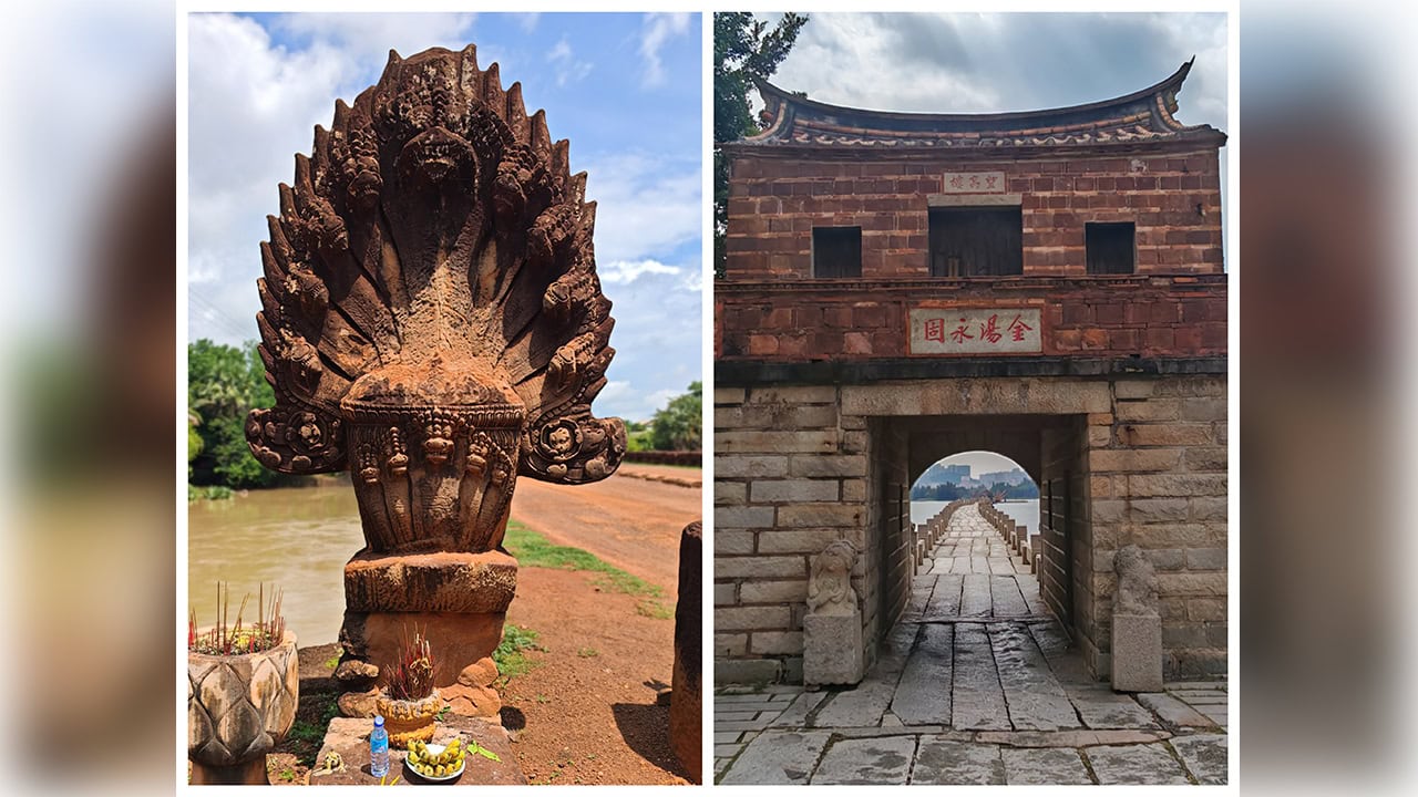
In the twelfth century, builders across Asia undertook ambitious infrastructure projects that would endure for nearly nine hundred years. While Chinese engineers constructed a massive tidal crossing in Fujian province, Khmer architects were developing stone-arched passages for the road system connecting parts of the Angkorian realm.
The Anping Bridge in Jinjiang and the Spean Praptos—widely referred to as Kampong Kdei Bridge—in Cambodia stand as remarkable examples of medieval construction, each adapted to distinct geographic conditions and transportation needs.
Engineering a Tidal Crossing
During a September visit by ASEAN journalists to Anhai town, local experts detailed how twelfth-century Chinese workers managed to build across unstable seabed conditions and strong currents. The bridge links Anhai in Jinjiang with Shuitou in Nan'an, both under Quanzhou's jurisdiction.
Work commenced in 1138 and reached completion fourteen years later in 1152. Stretching roughly 2.25 kilometers with a width varying between 2.9 and 4 meters, the structure became known locally as Wuli Bridge—a reference to its length of approximately five traditional Chinese li units.
The largest stone slabs measure around 11 meters in length, with the heaviest reaching 25 tonnes. Without modern lifting equipment, workers relied on boats to transport granite and exploited tidal movements to maneuver the massive blocks into position atop supporting columns.
Foundation stability posed a significant challenge in the soft mud. Engineers employed a "sleeper-log" method, placing timber beams beneath heavy stones that gradually settled into load-bearing strata. Over time, oyster colonies formed around submerged portions, their shells accumulating to reinforce and shield the masonry from wave damage.
The design incorporated three types of support columns tailored to water flow patterns: rectangular, single-pointed or half-boat forms, and double-pointed boat configurations. Official records cite 360 piers—290 rectangular, 44 single-pointed, and 26 double-pointed—creating 362 openings for water passage.
This crossing facilitated commercial and passenger movement between Quanzhou and southern regions during an era of flourishing maritime trade. In 2021, it received recognition as one of 22 locations within the UNESCO World Heritage designation "Quanzhou: Emporium of the World in Song–Yuan China."
A Khmer Royal Highway
The Kampong Kdei crossing in Chi Kreng district of Siem Reap province offers an instructive counterpoint from roughly the same historical moment. This approximately 87-meter structure is linked to the era of King Jayavarman VII and formed part of the transportation network radiating from Angkor.
Rather than employing long granite beams resting on numerous piers, Khmer builders used laterite blocks to create more than twenty corbelled archways. The bridge features nine-headed naga sculptures along its railings, merging functional design with religious meaning and artistic tradition.
Divergent Solutions to Common Problems
These two structures addressed similar infrastructure challenges through contrasting methods. The Chinese example served a maritime commercial network, exploiting tidal dynamics, timber foundations, and current-adapted pier designs. The Cambodian bridge carried travelers across a river within an overland transportation system.
Both have survived nearly nine centuries, demonstrating that such constructions represented far more than utilitarian passages—they embodied economic strength, technical expertise, and cultural values of their respective civilizations.